Horse Gulch Trail System
Horse Gulch Road
The Horse Gulch Road is a non-motorized use, 4.1-mile easy trail that provides access to the Horse Gulch trails.
Horse Gulch Road leads to the main intersection for trails near the Meadow Trail loop, and continues up towards Sugar Trail and access to the Skyline and Raider Ridge trails area.
- Length
- 4.1 Miles
- Climb
- 1100 Feet
- Difficulty
- Beginner
- From Durango
- 1.2 Miles
Getting there
Parking at Horse Gulch Trailhead. Begin at Main Avenue and 9th Street, then go east on 9th Street, toward Fort Lewis College Mesa. Right onto East 3rd Avenue, then left onto College Drive (6th Street). Right onto East 8th Avenue, then left onto East 3rd Street. The Horse Gulch Trail System lot is behind the Mercy Medicine parking.
Where it starts
The pin marks the trailhead. Map data © OpenStreetMap contributors.
Trail layout
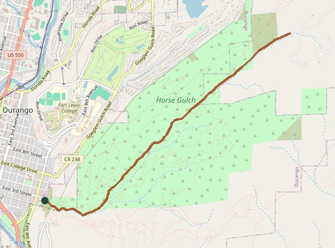
The line is the mapped path. Map data © OpenStreetMap contributors.