Hiking
Alien Run Trail System
Three stacked loops near the state line, with easier and harder options in the same ride-and-hike system.
- Length
- 16 miles
- Elevation gain
- 637 ft
- Difficulty
- Advanced, Beginner, Intermediate
- From Durango
- 33 miles
Getting there
Alien Run Trailhead To main trailhead: Access Hart Canyon, or from Safeway in Aztec, NM, drive four miles NE on US 550 towards Durango, CO. Make a right on County Road 2770 and drive 3 miles. Turn left turn near a small pumping station and travel .5 miles to the top of the hill. Right turn following a fence for .5 miles and park. Open and close the barb wire gate. Follow signs, tracks and red tags on trees. Rock markers on slickrock sections.
The trails
Each path in the system has its own tile. Length and climb sit underneath. Hover a tile for what the trail actually does. Pick a rating to see only those.
Intermediate
- IntermediateAlien Run TrailAlien Run is a 9.2-mile moderate loop in the Alien Run trail network.
9.2 Miles · 640 Feet of climbing
Alien Run is a 9.2-mile moderate loop in the Alien Run trail network.
Advanced
- AdvancedBlack Hole LoopThe Black Hole Loop is a 0.2-mile difficult loop in the Alien Run trail network.
0.7 Miles · 80 Feet of climbing
The Black Hole Loop is a 0.2-mile difficult loop in the Alien Run trail network.
- AdvancedOuter Limits TrailOuter Limits is a 6.7-mile moderate loop in the Alien Run trail network.
6.7 Miles · 628 Feet of climbing
Outer Limits is a 6.7-mile moderate loop in the Alien Run trail network.
Where it is
The pin marks the trailhead. Map data © OpenStreetMap contributors.
Trail layout
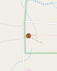
Trail layout from OpenStreetMap. The line is the mapped path that matched this name. A large system may show one path, not every loop. Map data © OpenStreetMap contributors.
Length and climb come from Durango Trails. A system with several trails lists each one above.