Hiking
Animas River Trail
The paved path along the river through town. Flat enough for any pace, and you can join it from almost anywhere in Durango.
The Animas River Trail (ART), a hard surface shared-use path, is a paved path that suits kids and anyone just starting out. It runs through the middle of Durango and is the backbone of the town trail network and a transportation backbone for the community.
- Length
- 7.1 miles
- Elevation gain
- 337 ft
- Difficulty
- Beginner
- From Durango
- 0 miles
Getting there
The path follows the Animas River and you can join it in several places. Santa Rita Park is one end. The north end of this popular trail is the intersection of the 32nd Street and East 3rd Avenue, and the southern end is at River Road, south of Escalante Drive. You can also park to access the Animas River Trail at Santa Rita Park, Schneider Park on Roosa Avenue, Memorial Park at West 12th Street (behind the Durango Fire Station), Rotary Park at the intersection of East 15th Street and East 2nd Avenue, the Durango Rec Center at 2700 Main Avenue, and at the intersection of East 29th Street and East 3rd Avenue.
Where it is
The pin marks the trailhead. Map data © OpenStreetMap contributors.
Trail layout
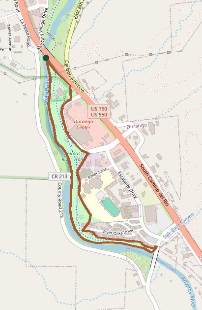
Trail layout from OpenStreetMap. The line is the mapped path that matched this name. A large system may show one path, not every loop. Map data © OpenStreetMap contributors.
Length and climb come from Durango Trails. A system with several trails lists each one above.