Boggy Draw Trail System
Italian Canyon Trail
Italian Canyon leaves Mavericks Loop about a third of the way around and heads east.
A few short climbs open onto views to the east and north.
- Length
- 6.1 Miles
- Climb
- 505 Feet
- Difficulty
- Intermediate
- From Durango
- 50 Miles
Getting there
Boggy Draw Trailhead. Begin at Main Avenue and 9th Street, then go west on 9th Street, toward Camino Del Rio. Make a left onto Camino Del Rio/ Hwy 550. Make a right onto US-160 West. Keep following 160-W for 27 miles then turn right onto CO-184 W in the town of Mancos. In 17 miles turn right onto CO-145 N toward the town of Dolores. In Dolores, turn left on N. 11th Street. Keep followingto CO-Road 41/Forest Service Road 526. In 2 miles turn right onto County Road W. In 1 mile, the parking spot for Boggy Draw will be on your left.
Where it starts
The pin marks an end of the mapped trail. Map data © OpenStreetMap contributors.
Trail layout
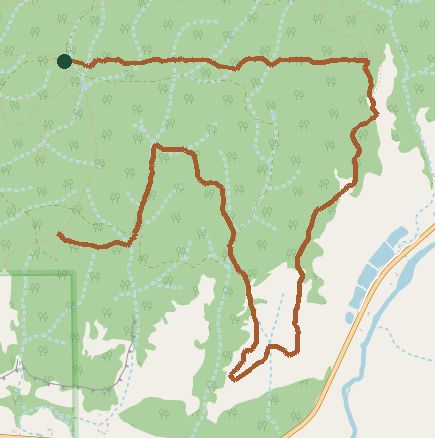
The line is the mapped path. Map data © OpenStreetMap contributors.