Hiking
Boggy Draw Trail System
A big network west of Dolores. The Boggy trailhead is the start of several loops, from easy to intermediate.
- Length
- 62 miles
- Elevation gain
- 775 ft
- Difficulty
- Beginner, Intermediate
- From Durango
- 50 miles
Getting there
Bean Canyon/Boggy Draw Access Point To main trailhead: Beginning in downtown Dolores, turn north off of Highway 145 onto 11th Street and follow the road (which becomes County Road 31) up to the top of the mesa. Turn right (east) on Road W and travel approximately one mile until you cross a cattle guard and the forest boundary. The parking lot and trailhead sits on the left side of road once you enter the Forest boundary.
The trails
Each path in the system has its own tile. Length and climb sit underneath. Hover a tile for what the trail actually does. Pick a rating to see only those.
Intermediate
- IntermediateMcPhee Overlook TrailMcPhee Overlook is a moderate 8.8-mile trail on the western side of the Boggy Draw trail system.
8.8 Miles · 880 Feet of climbing
McPhee Overlook is a moderate 8.8-mile trail on the western side of the Boggy Draw trail system.
- IntermediateBean Canyon TrailBean Canyon Trail is a well-used loop in the Boggy Draw/McPhee Reservoir trail system .
13.7 Miles · 1200 Feet of climbing
Bean Canyon Trail is a well-used loop in the Boggy Draw/McPhee Reservoir trail system .
- IntermediateBoggy Draw Upper LoopBoggy Draw Upper Loop is a moderate 10-mile trail.
10 Miles · 915 Feet of climbing
Boggy Draw Upper Loop is a moderate 10-mile trail.
- IntermediateBoggy Draw Lower LoopBoggy Draw Lower Loop is an 11-mile trail.
11.1 Miles · 1100 Feet of climbing
Boggy Draw Lower Loop is an 11-mile trail.
- IntermediateBoggy Draw Loop TrailThe Boggy Draw Loop Trail is the original trail in the Boggy Draw network .
6.4 Miles · 366 Feet of climbing
The Boggy Draw Loop Trail is the original trail in the Boggy Draw network .
- IntermediateItalian Canyon TrailItalian Canyon leaves Mavericks Loop about a third of the way around and heads east.
6.1 Miles · 505 Feet of climbing
Italian Canyon leaves Mavericks Loop about a third of the way around and heads east.
Other
- TrailMavericks Loop TrailMavericks Loop starts at the Boggy Draw Loop start of the trail and heads south, and then east.
6.1 Miles · 485 Feet of climbing
Mavericks Loop starts at the Boggy Draw Loop start of the trail and heads south, and then east.
Where it is
The pin marks the trailhead. Map data © OpenStreetMap contributors.
Trail layout
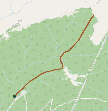
Trail layout from OpenStreetMap. The line is the mapped path that matched this name. A large system may show one path, not every loop. Map data © OpenStreetMap contributors.
Length and climb come from Durango Trails. A system with several trails lists each one above.