Colorado Trail System (High Country)
Sharkstooth Trail
Sharkstooth Trail is a 6.6 mile (one way) trail to Sharkstooth Pass, with many wide views of Hesperus Mountain as you go.
Sharkstooth begins with a difficult 1.6 mile uphill with a mixture of scree and smooth singletrack, then passes through multiple switchbacks before reaching treeline.
- Length
- 6.6 Miles
- Climb
- 1932 Feet
- Difficulty
- Advanced
- From Durango
- 23 Miles
Getting there
Sharkstooth Trailhead From Mancos, Colorado, go north on CR 42, which becomes Forest Road 561. Follow the signs to Transfer Campground and from there to Sharkstooth start of the trail. An ordinary car can usually to make it to Windy Gap, and 4WD vehicles can make a right on the road to Twin Lakes to drive directly to the start of the trail.
Where it starts
The pin marks an end of the mapped trail. Map data © OpenStreetMap contributors.
Trail layout
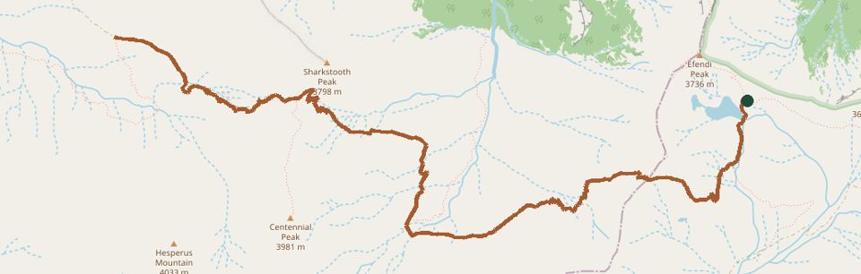
The line is the mapped path. Map data © OpenStreetMap contributors.