Colorado Trail System (Lower)
Dry Fork Trail
Popular among mountain bikers, trail runners, hikers and horseback riders, Dry Fork Loop is a popular singletrack trail that starts at the cattle guard on the west side of the Junction Creek Trailhead parking spot.
Climb about 1 mile to a split and turn left.
- Length
- 3.9 Miles
- Climb
- 1330 Feet
- Difficulty
- Intermediate
- From Durango
- 9 Miles
Getting there
Dry Fork Parking From downtown Durango, take US Hwy 160 west. Turn right on Lightner Creek Road (CR 207) and follow State Wildlife area (CR 208). Take one more right at the split toward Silver Mountain Ranch and a final left at the split away from Silver Mountain Ranch. This parking spot is the start of the Dry Fork Loop.
Where it starts
The pin marks the trailhead. Map data © OpenStreetMap contributors.
Trail layout
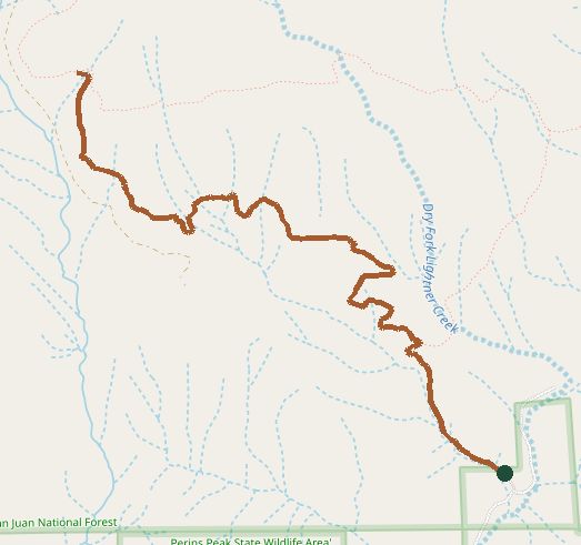
The line is the mapped path. Map data © OpenStreetMap contributors.