Hiking
Cutthroat Trail
A 5.5-mile trail above the East Fork of Hermosa Creek, starting where Relay Creek meets Cascade Divide Road.
The Cutthroat Trail is a 5.5 mile trail above the East Fork of Hermosa Creek starting at the intersection of Relay Creek and Cascade Divide Road. Phase one began in 2021 when crews established the initial 3.7 mile alignment from Cascade Divide Road to Sigg Creek Campground.
- Length
- 5.5 miles
- Elevation gain
- Elevation gain isn't listed
- Difficulty
- Beginner
- From Durango
- 30 miles
Getting there
Cutthroat Trailhead Parking Heading North on Main Street, keep following 550 for 32 miles to Purgatory Ski Resort. Pass through the parking spots to the north lot and follow the dirt road north (Hermosa Park Road). Continue until you reach the trailhead at the intersection of Hermosa Park Road and Relay Creek Road.
Where it is
The pin marks the trailhead. Map data © OpenStreetMap contributors.
Trail layout
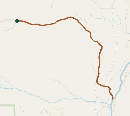
Trail layout from OpenStreetMap. The line is the mapped path that matched this name. A large system may show one path, not every loop. Map data © OpenStreetMap contributors.
Length and climb come from Durango Trails. A system with several trails lists each one above.