Hiking
Haviland Lake Trails
A 9-mile network between Elbert Creek and Highway 550, linking Haviland Lake and Chris Park. Hikers, horses, bikes, and snowshoers share it all year.
About 9 miles of trail sit between Elbert Creek and Highway 550, tying Haviland Lake Park to Chris Park. Horses, hikers, bikes, skiers, and snowshoers use it in every season.
- Length
- 9 miles
- Elevation gain
- 554 ft
- Difficulty
- Not listed
- From Durango
- 20.2 miles
Getting there
Haviland Lake Trailhead Parking Heading North on Main Street from town, keep followingto US-550 for 19 miles. Make a right onto Haviland Lake Road (just before Almostaranch) and follow left around the bend. Keep right past the lakeside parking lot and look for the trailhead just East.
Where it is
The pin marks the trailhead. Map data © OpenStreetMap contributors.
Trail layout
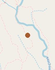
Trail layout from OpenStreetMap. The line is the mapped path that matched this name. A large system may show one path, not every loop. Map data © OpenStreetMap contributors.
Length and climb come from Durango Trails. A system with several trails lists each one above.