Hermosa Area Trail System
Hermosa Creek Trail
There are several route options including an there and back on the singletrack portion of Hermosa Creek Trail.
You will see several trail junctions as you go, but the main Hermosa Creek Trail is always the most well-worn route.
- Length
- 19.1 Miles
- Climb
- 2330 Feet
- Difficulty
- Advanced
- From Durango
- 35 Miles
Getting there
Northern Hermosa Creek Access Southern Hermosa Creek Access To access upper Hermosa Creek parking (near Purgatory): Take Highway 550 North from Downtown Durango. Turn left into Purgatory resort and park in one of its many parking spots and ride up the road or /shuttle to the top parking lot at Hermosa. To access Hermosa Creek Trail Out & Back: Take 550 North from Town and turn left at Hermosa Park Road. Cross the railroad tracks and follow up the road to the southern Hermosa Creek Trailhead located about 4 miles up Lower Hermosa Road which starts near the railroad track crossing in the small town of Hermosa north of Durango. Find the trail heading north near the junction of several dirt roads near the parking spot.
Where it starts
The pin marks the trailhead. Map data © OpenStreetMap contributors.
Trail layout
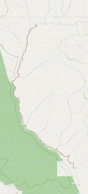
The line is the mapped path. Map data © OpenStreetMap contributors.