High Country Trails
Cascade Creek Trail
Cascade Creek Trail is an 8-mile moderately difficult hike or bike ride between Durango and Silverton.
Cascade Creek follows along the western base of the mountain and often sees less traffic than other well-used high-country trails in the area.
- Length
- 8.1 Miles
- Climb
- 835 Feet
- Difficulty
- Advanced
- From Durango
- 29 Miles
Getting there
Cascade Creek Parking Area. Begin at Main Avenue and 9th Street, then go west on 9th Street, toward Camino Del Rio (Highway 550). Make a right onto Camino Del Rio (HWY 550) and continue north on Hwy 550 past Purgatory Resort toward Silverton. 28.5 miles from Durango, there is a hairpin turn to the right at Cascade Creek. Turn left across the road at this turn onto Forest Service Road 783. Follow this road for approximately 3/4 mile to a small parking spot on the left. From here, the trail continues on the road over the bridge and quickly becomes singletrack. Make sure you have plenty of water, warm layers, and rain gear.
Where it starts
The pin marks the trailhead. Map data © OpenStreetMap contributors.
Trail layout
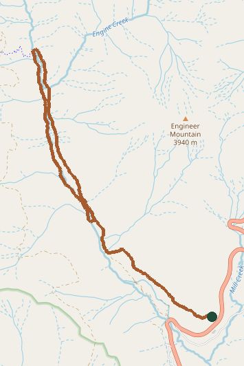
The line is the mapped path. Map data © OpenStreetMap contributors.