Hiking
High Country Trails
A catch-all page for the high trails outside town, the kind of mileage you pick apart into day hikes rather than walk in one go.
- Length
- 65 miles
- Elevation gain
- Climbs run from about 540 to 3,600 feet
- Difficulty
- Advanced, Beginner, Expert, Intermediate
- From Durango
- 30 miles
Getting there
Purgatory Resort To main trailhead: Many of the high country trails have proximate parking spots and access points; however, Purgatory Resort acts as a “hub” for high country adventure. From Durango heading north on Highway 550, turn left into Purgatory Resort (Purgatory Blvd) and park in one of the many parking spots at the resort. Purgatory resort offers dozens of miles of lift-access trails on the mountain including the renown 1993 World’s Cup Course.
The trails
Each path in the system has its own tile. Length and climb sit underneath. Hover a tile for what the trail actually does. Pick a rating to see only those.
Advanced
- AdvancedColumbine/Ruby LakesRuby Drainage Traverse runs at and above the trees, so you can see the valley.
8.1 Miles · 1588 Feet of climbing
Ruby Drainage Traverse runs at and above the trees, so you can see the valley.
- AdvancedWhitehead TrailWhite Creek Trail is a difficult and scenic high country trail near Cunningham Gulch and Highland Mary Lakes trails.
8.7 Miles · 1950 Feet of climbing
White Creek Trail is a difficult and scenic high country trail near Cunningham Gulch and Highland Mary Lakes trails.
- AdvancedCrater Lake TrailThe route starts at Andrews Lake just south of Molas Pass on US 550.
5.4 Miles · 1300 Feet of climbing
The route starts at Andrews Lake just south of Molas Pass on US 550.
- AdvancedDeer Creek TrailDeer Creek Trail is a scenic trail which parallels Deer Creek just off of Highway 550.
4.7 Miles · 2100 Feet of climbing
Deer Creek Trail is a scenic trail which parallels Deer Creek just off of Highway 550.
- AdvancedEast Fork TrailThe East Fork trail (FS #638) is 6.5 miles long.
6.6 Miles · 1400 Feet of climbing
The East Fork trail (FS #638) is 6.5 miles long.
- AdvancedCunningham GulchCunningham Gulch (FS#502) Leaving the start of the trail behind, the first half mile of the route rises through...
1.8 Miles · 1350 Feet of climbing
Cunningham Gulch (FS#502) Leaving the start of the trail behind, the first half mile of the route rises through...
- AdvancedGraysill TrailGraysill Trail is a nice, once forgotten trail that has been adopted by a local from Silverton.
2.4 Miles · 1768 Feet of climbing
Graysill Trail is a nice, once forgotten trail that has been adopted by a local from Silverton.
- AdvancedHighland Mary LakesReaching the spectacular high alpine tundra of the Weminuche Wilderness usually requires a multi-day backpacking trip.
3 Miles · 1500 Feet of climbing
Reaching the spectacular high alpine tundra of the Weminuche Wilderness usually requires a multi-day backpacking trip.
- AdvancedWest Lime Creek
2.5 Miles · 1100 Feet of climbing
- AdvancedCoal Creek TrailCoal Creek is a well-used downhill bike route to the highway, accessed from Deer Creek Trail or Engineer Mountain...
3 Miles · 1550 Feet of climbing
Coal Creek is a well-used downhill bike route to the highway, accessed from Deer Creek Trail or Engineer Mountain...
- AdvancedCascade Creek TrailCascade Creek Trail is an 8-mile moderately difficult hike or bike ride between Durango and Silverton.
8.1 Miles · 835 Feet of climbing
Cascade Creek Trail is an 8-mile moderately difficult hike or bike ride between Durango and Silverton.
- AdvancedPass Creek TrailPass Trail is a great mountain bike ride or hike for most everyone.
2.7 Miles · 1000 Feet of climbing
Pass Trail is a great mountain bike ride or hike for most everyone.
- AdvancedEngineer Mountain TrailEngineer Mountain is a favorite hike or ride that is well marked and in close proximity to Durango, making it...
9.2 Miles · 3600 Feet of climbing
Engineer Mountain is a favorite hike or ride that is well marked and in close proximity to Durango, making it...
Where it is
The pin marks the trailhead. Map data © OpenStreetMap contributors.
Trail layout
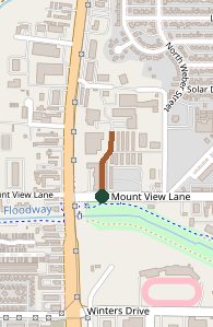
Trail layout from OpenStreetMap. The line is the mapped path that matched this name. A large system may show one path, not every loop. Map data © OpenStreetMap contributors.
Length and climb come from Durango Trails. A system with several trails lists each one above.