High Country Trails
Coal Creek Trail
Coal Creek is a well-used downhill bike route to the highway, accessed from Deer Creek Trail or Engineer Mountain Trail.
- Length
- 3 Miles
- Climb
- 1550 Feet
- Difficulty
- Advanced
- From Durango
- 35 Miles
Getting there
Coal Creek Trail Road-side Parking. Begin at Main Avenue and 9th Street, then go west on 9th Street, toward Camino Del Rio (Highway 550). Make a right onto Camino Del Rio (HWY 550) and continue north on Hwy 550 past Purgatory Resort toward Silverton. Coal Bank Pass is 35 miles north of Durango, 13.5 miles south of Silverton, on Hwy 550. Slow down after mile marker 56 (it’s between mm 56 and 57), and you will see a parking spot and restroom facility on the east side of the road at Coal Bank Pass with a pull off spot with restroom facilities (but don’t park there). Instead, Continue north on Highway 550 to where the road makes the next sharp right-hand turn. There is a small dirt pull-off area to the west side of the road, this is where Coal Creek trail begins.
Where it starts
The pin marks an end of the mapped trail. Map data © OpenStreetMap contributors.
Trail layout
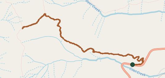
The line is the mapped path. Map data © OpenStreetMap contributors.