High Country Trails
Deer Creek Trail
Deer Creek Trail is a scenic trail which parallels Deer Creek just off of Highway 550.
Deer Creek trail is a difficult, 4.6-mile trail that climbs steadily toward Jura Knob to meet Coal Creek, then Engineer Mountain Trail.
- Length
- 4.7 Miles
- Climb
- 2100 Feet
- Difficulty
- Advanced
- From Durango
- 37 Miles
Getting there
Roadside Parking Area near Deer Creek (Highway 550) Molas Pass Trailhead Cascade Creek Parking Area Access # 1: Roughly 36 miles north of Durango on U.S. Highway 550, there is a tight right-hand turn with a pull-off area near Deer Creek. This parking spot is unmarked and easy to drive past. This trail is often used as an ending-point for a downhill bike route from Engineer Mountain Trail or Coal Creek Trail, with many cars shuttled here for bikers.
Where it starts
The pin marks an end of the mapped trail. Map data © OpenStreetMap contributors.
Trail layout
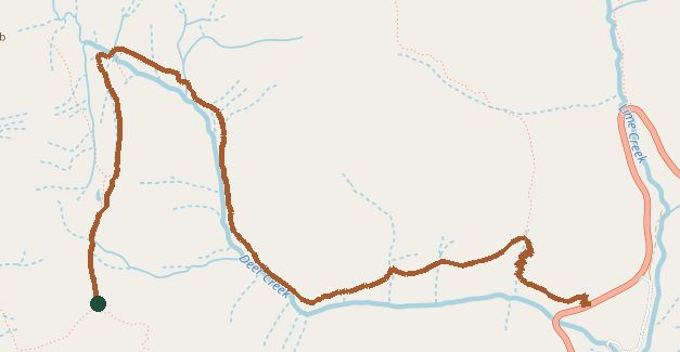
The line is the mapped path. Map data © OpenStreetMap contributors.