Hiking
Ice Lakes Trail
The basin above South Mineral Creek, west of Silverton. Durango Trails still marks the trail closed after the 2020 fire. Check with the Forest Service before you go.
A fire was reported on the afternoon of October 19, 2020, west of Silverton, CO on the north side of the South Mineral Creek Road (FS585). The fire area included the Ice Lakes Trail and the Clear Lake Road.
Durango Trails still marks this trail closed after the 2020 Ice Lakes fire. Confirm the current order with the Forest Service before you go.
- Length
- 7 miles
- Elevation gain
- 2430 ft
- Difficulty
- Expert, Intermediate
- From Durango
- 54 miles
Getting there
Ice Lakes Trailhead Take Hwy 550 North for 47 miles, then stay left upon entering Silverton to stay on Hwy 550 North. After 2 miles, make a left onto County Rd 7/Forest Rd 585. The start of the trail is approximately 4 miles up the road on your right.
Where it is
The pin marks the trailhead. Map data © OpenStreetMap contributors.
Trail layout
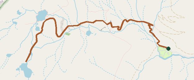
Trail layout from OpenStreetMap. The line is the mapped path that matched this name. A large system may show one path, not every loop. Map data © OpenStreetMap contributors.
Length and climb come from Durango Trails. A system with several trails lists each one above.