Hiking
La Plata Canyon Trail System
Mid-country trails up La Plata Canyon, west of town, including the steep routes toward Kennebec Pass.
- Length
- 32 miles
- Elevation gain
- About 2,800 feet of climbing
- Difficulty
- Advanced, Beginner, Expert, Intermediate
- From Durango
- 18 miles
Getting there
La Plata Canyon Parking Area To main start of the trail: Go west on Highway 160 about 10 miles from Durango. You will be in the town of Hesperus. Before you hit the Hesperus Ski Hill, make a right hand turn on to La Plata Canyon Road at the Kennebec Cafe. Drive on this road for 6-14 miles. There will be dirt roads as you go that were old mining roads and you can explore any of these. There will be an obvious spot when the road comes out of a canyon, and there is another road that branches off that is not nearly as wide or traveled that leads to a bridge.
The trails
Each path in the system has its own tile. Length and climb sit underneath. Hover a tile for what the trail actually does. Pick a rating to see only those.
Advanced
- AdvancedLa Plata CanyonLa Plata Canyon trail is a long sustained climb up the La Plata Canyon Road.
9.3 Miles · 2800 Feet of climbing
La Plata Canyon trail is a long sustained climb up the La Plata Canyon Road.
Where it is
The pin marks the trailhead. Map data © OpenStreetMap contributors.
Trail layout
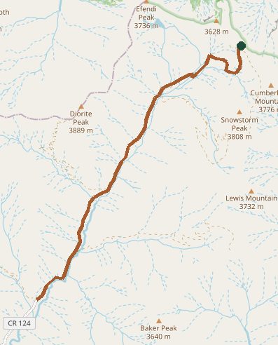
Trail layout from OpenStreetMap. The line is the mapped path that matched this name. A large system may show one path, not every loop. Map data © OpenStreetMap contributors.
Length and climb come from Durango Trails. A system with several trails lists each one above.