Overend Mountain Park Trail System
Ned’s Hill Trail
Ned’s Hill (named after Durangoan Ned Overend) can be reached from Grabens Loop, Perins Gulch, and Englehart’s trails.
Ned’s Hill is a 0.3-mile downhill that offers fun and moderately technical roller-coaster ups and downs toward Leyden Street trailhead.
- Length
- 0.5 Miles
- Climb
- 330 Feet
- Difficulty
- Intermediate
- From Durango
- 2 Miles
Getting there
Parking at Leyden Street Parking at Crestview Street Parking at Hidden Valley To Leyden Street. Begin at Main Avenue and 9th Street, then go west on 9th Street, toward Camino Del Rio. Cross the river over Camino Del Rio on 9th Street and turn right onto Roosa Avenue. Make a left onto El Paso Street, and turn right onto Forest Avenue. Make a left onto Leyden Street and continue to the end of the cul-de-sac to the trailhead.
Where it starts
The pin marks an end of the mapped trail. Map data © OpenStreetMap contributors.
Trail layout
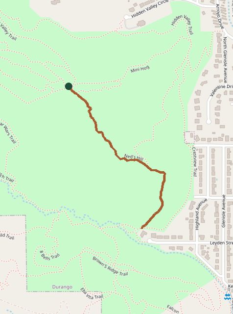
The line is the mapped path. Map data © OpenStreetMap contributors.