Hiking
Perins Peak Trail
A long, steep day hike to Perins Peak on the west side. One of the harder in-town summits, and parts of the wildlife area close seasonally.
, but following the trail markers for Perins Peak, or alternatively, starting where Rockridge Dr. Intersect and taking the back way up the mountain.
- Length
- 6.7 miles
- Elevation gain
- 1750 ft
- Difficulty
- Advanced, Intermediate
- From Durango
- 3 miles
Getting there
Perins Vista Drive (Rockridge) From downtown Durango, take Main Avenue north to 25th Street, turn left and travel west. Make a left onto Clovis Drive and head up the hill to the Rockridge subdivision. Turn right on Tanglewood Drive, and at the end of the street watch for a lot for Perins Peak trail.
Where it is
The pin marks the trailhead. Map data © OpenStreetMap contributors.
Trail layout
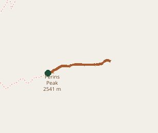
Trail layout from OpenStreetMap. The line is the mapped path that matched this name. A large system may show one path, not every loop. Map data © OpenStreetMap contributors.
Length and climb come from Durango Trails. A system with several trails lists each one above.