Hiking
Sand Canyon Trail System
Canyons of the Ancients, near Cortez. Pueblo sites along a desert trail system, not a Durango city hike.
- Length
- 19 miles
- Elevation gain
- 656 ft
- Difficulty
- Advanced, Beginner, Intermediate
- From Durango
- 61 miles
Getting there
Main Trailhead (Canyon of the Ancients Parking Area) Secondary Canyon of the Ancients Parking Area Sand Canyon Pueblo Parking Area To main trailhead: Sand Canyon Trails are located about 12 miles north of Cortez on Highway 184. To reach the McElmo Canyon trailhead, travel south of Cortez on Highway 491. Turn right (west) on County Road G at the signs for the airport and/or Hovenweep National Monument. Go 12 miles on this paved road. Trailhead parking is an unimproved slickrock surface on the north (right) side of the road. An additional parking spot was added to Sand Canyon just east of the Canyon of the Ancients main trailhead. A 0.4-mile singletrack trail connects this secondary parking spot to the main trail system.
The trails
Each path in the system has its own tile. Length and climb sit underneath. Hover a tile for what the trail actually does. Pick a rating to see only those.
Intermediate
- IntermediateBlue Trail (Slickrock)Blue Trail (Slickrock) is a moderate, 1.2-mile trail in the Sand Canyon trails system.
1.2 Miles · 180 Feet of climbing
Blue Trail (Slickrock) is a moderate, 1.2-mile trail in the Sand Canyon trails system.
Advanced
- AdvancedRock Creek TrailRock Creek is a well-used trail in Sand Canyon.
3.9 Miles · 540 Feet of climbing
Rock Creek is a well-used trail in Sand Canyon.
- AdvancedEast Rock Creek TrailEast Rock Creek is a well-used loop in Sand Canyon.
5.1 Miles · 760 Feet of climbing
East Rock Creek is a well-used loop in Sand Canyon.
- AdvancedSand Canyon TrailSand Canyon Trail is a moderate/difficult there-and-back trail.
6.3 Miles · 2070 Feet of climbing
Sand Canyon Trail is a moderate/difficult there-and-back trail.
Where it is
The pin marks the trailhead. Map data © OpenStreetMap contributors.
Trail layout
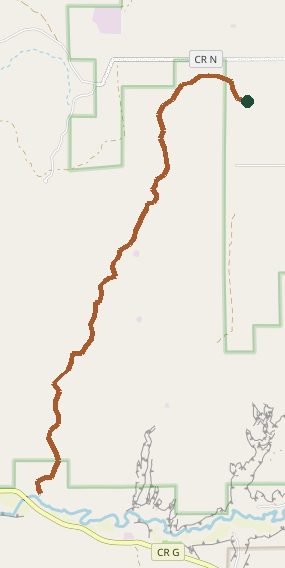
Trail layout from OpenStreetMap. The line is the mapped path that matched this name. A large system may show one path, not every loop. Map data © OpenStreetMap contributors.
Length and climb come from Durango Trails. A system with several trails lists each one above.