Hiking
Saul's Creek Trail System
A smaller forest system about 3 miles east of Bayfield.
- Length
- 4 miles
- Elevation gain
- 330 ft
- Difficulty
- Advanced, Beginner, Intermediate
- From Durango
- 24 miles
Getting there
Main Trailhead (Road 755A) To main start of the trail: To get to the Saul’s Creek start of the trail, drive east on Highway 160 from Bayfield. Make a right on CR 526 (with the sign “National Forest Access, Saul’s Creek). Take the first left on CR 527 and the signed start of the trail is about 1 mile down the road.
The trails
Each path in the system has its own tile. Length and climb sit underneath. Hover a tile for what the trail actually does. Pick a rating to see only those.
Intermediate
- IntermediateRidge Trail (in Saul’s Creek)Saul's Creek is San Juan National Forest land about 3 miles east of Bayfield, on old gas roads and doubletrack.
3.1 Miles · 460 Feet of climbing
Saul's Creek is San Juan National Forest land about 3 miles east of Bayfield, on old gas roads and doubletrack.
- IntermediateSaul’s Creek TrailSaul's Creek is San Juan National Forest land about 3 miles east of Bayfield, on old gas roads and doubletrack.
1.2 Miles · 200 Feet of climbing
Saul's Creek is San Juan National Forest land about 3 miles east of Bayfield, on old gas roads and doubletrack.
Where it is
The pin marks the trailhead. Map data © OpenStreetMap contributors.
Trail layout
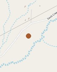
The map shows the trailhead area. Map data © OpenStreetMap contributors.
Length and climb come from Durango Trails. A system with several trails lists each one above.