Hiking
Smelter Mountain Trail
A short, steep climb on the south side of town. About a mile from the parking area to the view, gaining about 1,000 feet.
Smelter Mountain is a popular day hike in Durango that has a view of the Animas Valley and Downtown Durango. The hike is 1-mile from the parking spot to the top and climbs steadily 1,000 feet to spectacular views.
The upper loop closes for wildlife from December 1 to April 15.
- Length
- 1.1 miles
- Elevation gain
- 1000 ft
- Difficulty
- Advanced, Beginner, Intermediate
- From Durango
- 2 miles
Getting there
Smelter Mountain Parking Area. Begin at Main Avenue and 9th Street, then go west on 9th Street, toward Camino Del Rio. On Camino Del Rio (Highway 550) turn left and continue left onto Highway 160 East. Take a slight right onto Frontage Road (across from Nature’s Oasis) and then a right onto CR 210. Make a right onto Smelter Place and find a dirt parking area to your left at the base of Smelter Mountain.
Where it is
The pin marks the trailhead. Map data © OpenStreetMap contributors.
Trail layout
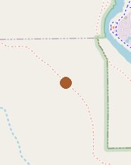
The map shows the trailhead area. Map data © OpenStreetMap contributors.
Length and climb come from Durango Trails. A system with several trails lists each one above.