Twin Buttes Trail System
Twin Buttes Trail
Twin Buttes Trail is a popular, difficult route in the Twin Buttes trail system.
This trail starts out with a steep, switchbacked climb out of the parking spot, crosses an old road then climbs again through pinion and juniper.
- Length
- 1.9 Miles
- Climb
- 650 Feet
- Difficulty
- Advanced
- From Durango
- 2.5 Miles
Getting there
Trail Parking Lot (near Speedway gas station) From Durango, go west on Highway 160. After about 1.5 miles watch for a dirt parking lot near the Speedway gas station on the North side of the road. Turn right into the trailhead parking lot. You can also keep following Hwy 160 to the second access trail which is on Lightner Creek Road (CR 207).
Where it starts
The pin marks the trailhead. Map data © OpenStreetMap contributors.
Trail layout
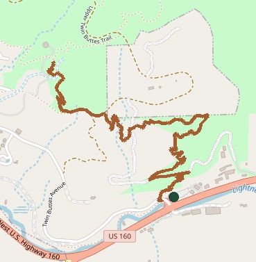
The line is the mapped path. Map data © OpenStreetMap contributors.