Vallecito Lake Trail System
Cave Basin Trail
Drive up Middle Mountain Road (USFS Road # 724 gravel) to the turn off at the ten mile marker.
Cave Basin Trail starts at an elevation of 10,800 ft.
- Length
- 5.4 Miles
- Climb
- 1720 Feet
- Difficulty
- Expert
- From Durango
- 29 Miles
Getting there
Cave Basin Trails Area From 9th Street & Main Avenue in Durango, travel north on Main Avenue (Highway 550). Turn right on 32nd Street (CR 251) and continue. Take another right onto CR 250, and then a left at the light onto Florida Road (CR 240). Keep following CR 240 for 11.8 miles, then turn right to stay on CR 240 for 2.8 more miles. Make a left onto CR 501, turn left again onto Middle Mountain Road. Middle Mountain Rd turns slightly left and becomes Forest Service Road; your destination will be on your left.
Where it starts
The pin marks an end of the mapped trail. Map data © OpenStreetMap contributors.
Trail layout
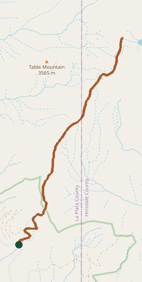
The line is the mapped path. Map data © OpenStreetMap contributors.