Vallecito Lake Trail System
Lake Eileen Trail
The four-mile round trip hike gains 1,140 feet in elevation and takes approximately four hours.
To access the trail, take CR 501 north of the lake and look for the Forest Service Work Center; a start of the trail sign is visible from the road.
- Length
- 4.2 Miles
- Climb
- 1150 Feet
- Difficulty
- Advanced
- From Durango
- 29 Miles
Getting there
Parking Near Vallecito Lake Trailhead From 9th Street & Main Avenue in Durango, travel north on Main Avenue (Highway 550). Turn right on 32nd Street (CR 251) and continue. Take another right onto CR 250, and then a left at the light onto Florida Road (CR 240). Keep following CR 240 for 11.8 miles, then turn right to stay on CR 240 for 2.8 more miles. Make a left onto CR 501, and continue for 9.7 miles. Make a left onto CR 500 then turn left where the Vallecito Creek Trailhead will be on your right.
Where it starts
The pin marks an end of the mapped trail. Map data © OpenStreetMap contributors.
Trail layout
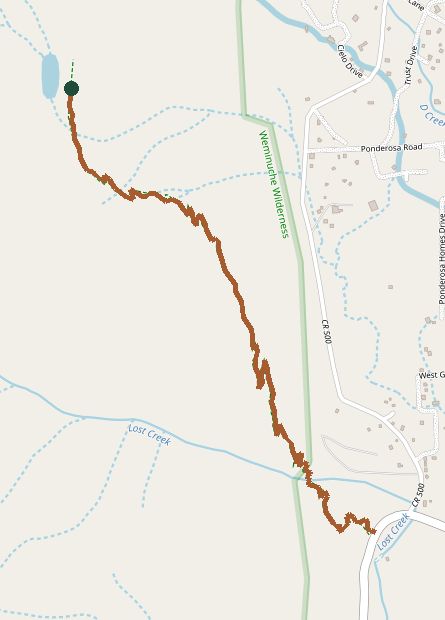
The line is the mapped path. Map data © OpenStreetMap contributors.